A tropical storm is no longer expected to form, but South Florida starting to flood
READ MORE
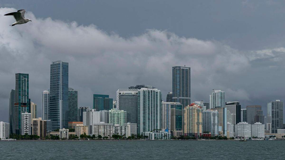
Tropical weather in South Florida
How Florida will be affected by a tropical system heading to the state from the Gulf of Mexico.
Expand All
A tropical storm named Alex is no longer expected to form from the messy, disorganized disturbance heading toward Florida, forecasters say. But tropical storm warnings are still in effect for the region and a flash flood warning for Miami-Dade and Broward was posted overnight.
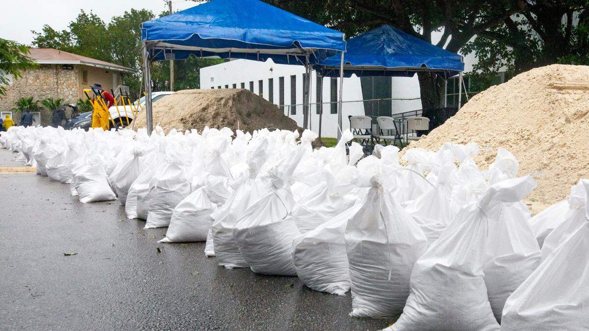
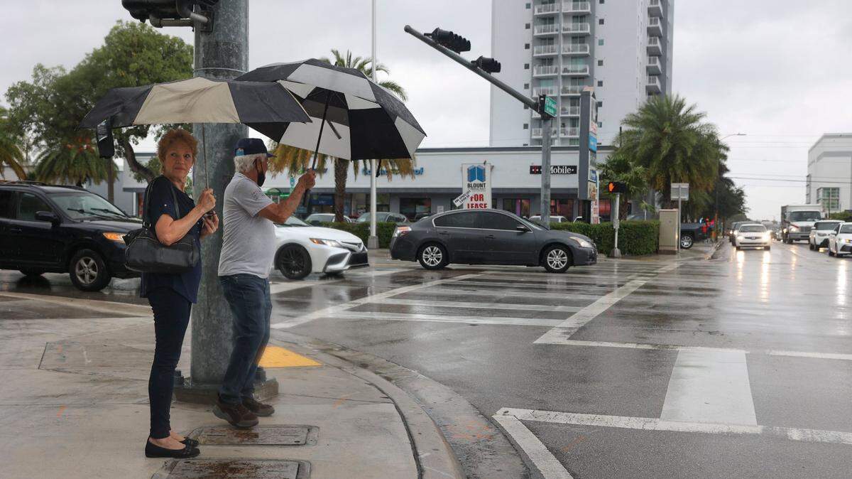
Miami Fire-Rescue reported calls about “multiple cars” stuck in water. Pockets of flooding, reported mainly in downtown Miami, Brickell, Miami Beach and Hollywood, could worsen through Saturday morning as the no-name storm continues to drop rain.
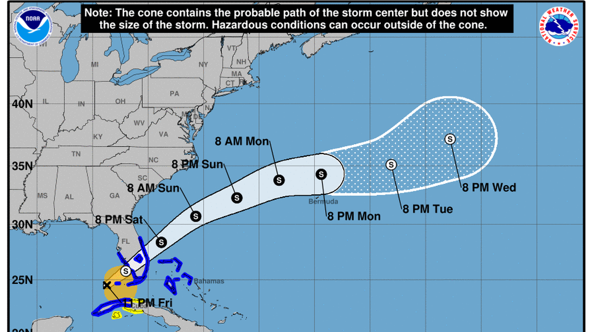
As of Saturday’s 8 a.m. update from the center, the system’s movement sped up to 18 mph and is heading northeast with maximum sustained winds around 40 mph, nearly the top of the hurricane center’s predictions for its path across Florida.
South Florida will feel the strongest winds and rain Saturday. The real threat is rain — with four to eight inches forecast for most of South Florida and up to 12 inches in some spots. That spells more flooding for much of the region, potentially including dangerous flash flooding.
Miami-Dade Mayor Daniella Levine Cava said the county is monitoring the storm and asked residents to stay vigilant as the storm draws closer. She said some county workers have been moved to an overnight schedule to monitor for flooding and power outages.
”We’re on the alert,” she said.
Looking for a center
Hurricane hunters are exploring the system from the air. They’re looking for a defined center, which would earn the disturbance the designation of tropical storm and the name Alex.
But the center of this lopsided system is not well-defined, and that makes tracking it harder. If the hurricane hunters find the disturbance’s center in a different place than expected, or if it re-forms and moves as it approaches Florida, it could shift the forecast track north or south across the state.

Through the course of Friday, forecasters said the system was a little less organized and still lacked the needed criteria to be a tropical cyclone, as of the NHC’s 11 p.m. update.
“Since there is no real center of circulation, the initial motion is uncertain, but the overall envelope is moving northeastward....” forecasters said.
Another factor to a lack of formation is wind sheer.
The warm waters of the Gulf of Mexico are usually a friendly place for storms to strengthen, but the latest satellite maps show a good bit of wind shear, which unsettles storms and keeps them weaker.
That wind shear is expected to keep all the heavy rains to the east of the system’s center, and it could prevent the disturbance from strengthening too much. The hurricane center’s highest prediction over Florida is 45 mph maximum winds.
Although the cone of uncertainty shows the storm’s center passing through the middle of the state, leaving most of South Florida and the Keys outside of the shaded zone, the impacts will mostly be felt below the storm’s center.
The southern half of the state could see nearly a foot of rain, and Sarasota County all the way to the Keys could see up to three feet of storm surge.

Although the main threat of this system is rain, South Florida will feel some tropical-storm-force winds. The National Weather Service predicts that sustained winds will remain around 20 mph throughout the region, but with a fierce spike around 6 a.m. Saturday.
It will be highest in Miami, with a peak at 44 mph sustained winds with 56 mph gusts. Broward will see a similar but lower spike, around 34 mph sustained with 45 mph gusts. The Keys are expected to feel ever less of the high winds, with gusts around 30 mph around the same time.
By Saturday evening, the worst of the winds and rain are likely to have passed.
Preparations, but no evacuations, in the Keys
A tropical storm warning is in effect throughout the Florida Keys, but Monroe County isn’t ordering evacuations or opening shelters, county spokeswoman Kristen Livengood said in a statement.
She urged residents and tourists to take precautions and have everything they need to weather the storm before Friday evening, especially those staying in areas prone to flooding. These include certain sections in the city of Key West and neighborhoods along Florida Bay in the Upper Keys.
Neighborhoods like Stillwright Point and Twin Lakes in Key Largo are especially susceptible to coastal flooding in tropical storms and during periods of unusually high tides.
“Monroe County Emergency Management encourages all residents and visitors to be off the road and seek safe shelter with friends or family by nightfall,” Livengood said.
Forecasters expect squalls and frequent gusts, including tropical-storm-force gusts, into Saturday morning. Livengood said isolated tornadoes are also possible through Saturday night.
Tropical storm warnings issued
A tropical storm warning is in effect for the west coast of Florida (from south of the Middle of Longboat Key to Englewood), the east coast of Florida south of the Volusia/Brevard County Line to Card Sound Bridge, Lake Okeechobee, Northwestern Bahamas, the Cuban provinces of Mayabeque, Havana, Artemisa, Pinardel Rio.
The hurricane center says tropical storm conditions were expected in the warning area in Cuba Friday, with Florida starting to feel the storm Saturday. The northwestern Bahamas could start to feel tropical storm conditions on Saturday.
NOAA already predicted this would be an active hurricane season, with up to 21 named storms and 6 to 10 hurricanes. Hurricane season officially started June 1 and stretches until Nov. 30, with the peak of the season in August and September.
Miami Herald staff writers Devoun Cetoute, Michelle Marchante and David Goodhue contributed to this report
This story was originally published June 3, 2022 at 8:11 AM with the headline "A tropical storm is no longer expected to form, but South Florida starting to flood."