The Little River’s polluted flow fuels Biscayne Bay troubles. Scientists taking a deeper look
READ MORE
Biscayne Bay on the Brink
Expand All
In the month before a massive fish kill in Biscayne Bay last year, an astounding amount of water flowed out of Miami’s Little River, one of the county’s most polluted waterways. The volume of water — fouled with not just floating trash but high concentrations of chemicals and waste — was three times higher than in any month in more than three decades.
Not long after, fish and other marine life began going belly-up. The evidence of Biscayne Bay’s decline has been accumulating for years beneath the surface but the fish kill was a stinking mess impossible for the public and political leaders to ignore. Dissolved oxygen dropped to fatal levels just about where the Little River meets the bay, according to readings from scientists and the Florida Department of Environmental Protection. That’s right where countless fish, big and small, died.
In the year since, Miami-Dade County has pledged to clean up the bay — starting with figuring out what the biggest problems are. Scientists still don’t have clear answers but atop the list of suspects are once-natural rivers converted into drainage canals that funnel contaminated urban floodwater into the bay.
The Little River may not be the biggest source of nasty stuff but because of the large number of failing septic systems and other pollution sources along the long and mostly developed riverbank and the wider basin, experts believe it may have the highest concentration of human waste and damaging nutrients. Its pollution may also create the most damaging impact. So figuring out what’s in the river, its flow patterns and how much dirty water gets dumped into the bay is a priority.
“What we have seen with the Little River over time is a consistent loading of pollution that’s producing an ecological collapse in that part of the bay,” said Pamela Sweeney, manager of the restoration and enhancement section at the county’s Division of Environmental Resources Management. “That canal is consistently above the nutrient levels that we believe the bay can handle.”
Stretches of the Little River are still beautiful, teeming with birds and manatees as it runs through residential areas like El Portal. Residents call it a hidden gem. Still, there are more pollution hot spots in the Little River than in any other major canal in Miami-Dade.
Fecal bacteria levels — indicators of human waste — are typically higher than those in the Miami River. The main suspect for that are low-lying septic tanks that regularly fail. Dissolved oxygen levels, a measure of how much oxygen is available for fish and other marine life, are consistently lower than in other canals. Chlorophyll levels, which indicate the presence of algae growth as a result of pollution, are higher, according to DERM.
But it’s unclear what exactly causes all that pollution. The county and academic researchers are looking at septic, sewage and stormwater systems and other infrastructure along with water flow and circulation to identify the sources of pollution. Those answers will help assess how big a contribution water from the Little River has on the health of the northern part of the bay.
A winding, polluted path
The waterway, one of Miami’s four original rivers before South Florida’s geography was completely altered by decades of draining and canal-cutting, is clearly the county’s most polluted river by at least one measure: trash.
A thick crust of discarded milk cartons, soda bottles, Styrofoam takeout containers, plastic cafecito cups and construction debris regularly blankets areas around trash booms along the river. Sometimes the pile of trash captured by a boom placed just before a dam north of Northeast 82nd Street is so heavy that a crane has to be used to collect stuff like sofas, doors, mattresses and pallets. Every year the South Florida Water Management District collects more than 120 tons of trash, or the weight of a blue whale, from the Little River. From the Miami River, by comparison, the district removes just 16 tons per year, about the weight of two African elephants.
The Little River winds its way through 12 miles of densely populated communities including Hialeah and Hialeah Gardens, sections of unincorporated Miami-Dade, El Portal and a series of Miami neighborhoods including Larchmont Gardens, the Upper East Side, Shorecrest and Belle Meade. It’s also a major drainage conduit for neighborhoods as far inland as Opa-locka and Doral.
Hundreds of homes on septic tanks that are increasingly failing are just a few feet away from its banks. Shopping malls, Miami Dade College’s north campus and six golf courses surround the waterway’s wider drainage basin. Industrial facilities like truck parking lots, ship container servicing companies, a cement distribution center and even a paper mill are also in close proximity to its murky waters, as they make their way to Biscayne Bay.
While these industrial facilities are permitted to operate in the area, compliance with the rules is not well monitored and oversight of waste disposal is insufficient, according to the county’s Chief Bay Officer Irela Bagué. There are also other unanswered questions about how much surface and ground water flow into the Little River, which runs through the lowest elevations in the county, said Piero Gardinali, associate director at Florida International University’s Institute of Environment, leading the Freshwater Resources Division.
“The Little River has a long history of pollution. But there seems to be a disagreement on how much water comes out of the river, and how much pollution, and where all that is coming from,” he said. ”Scientifically speaking, we’re still trying to understand if the river is what caused the fish kill last year, or if large discharges were the last straw. So even today, we’re trying to figure it out.”
Flooding and septic leaks
Nearly 2,000 septic tanks surround the canal and 80,000 more are in the wider basin. They are so problematic that Mayor Daniella Levine Cava made it a priority to connect them to the sewer system, before any other place in the county. Stormwater drainage systems haven’t kept up with growth in the area, so flooding is a constant issue. And then there’s sea level rise, making the groundwater creep up around the Little River. The more groundwater rises, the more septic systems tend to fail, leaching waste into the river and the bay.
Miami Waterkeeper, a nonprofit that advocates for the health of the county’s waterways, conducts regular sampling of water in the main canals and the bay. During the first six weeks of the summer, the Little River had the top levels of fecal bacteria contamination — all above EPA standards — among 20 spots sampled in Miami-Dade’s waterways sampled on a weekly basis.
Scientists are trying to measure if the river is also a leading source of nutrient pollution going into the bay, especially phosphorus. Unlike nitrogen, which is converted into gas by bacteria in the water, phosphorus is cumulative and sticks around waterways for a long time. This chemical occurs naturally and is essential for the growth of plants.
But too much of it can choke life in the bay. Development over the past century created an overabundance of phosphorus flowing into coastal waters, coming form agriculture fertilizers, organic waste in sewage and industrial runoff. It travels around Miami-Dade’s waterways, originating in leaky septic tanks and sewage pipe leaks, and fertilizer runoff in stormwater.
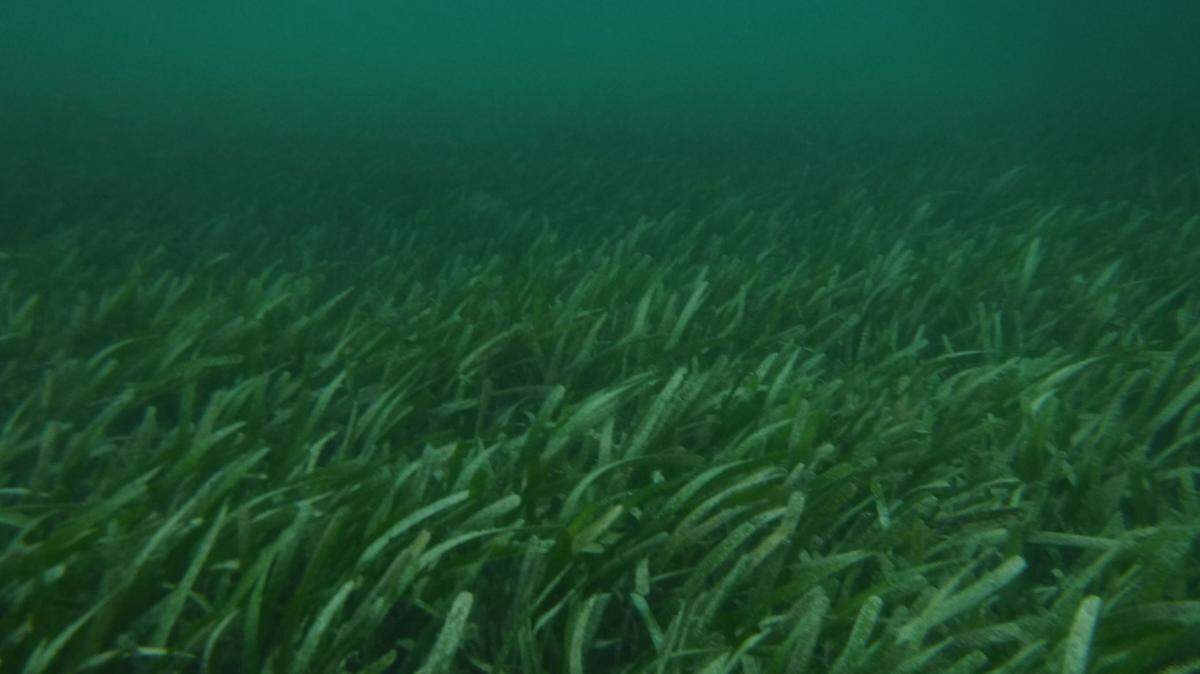
The constant trickle of phosphorus from the Little River into the bay feeds macroalgae that compete for oxygen with fish and kill seagrass meadows, which are essential for keeping the bay healthy, said FIU biology professor and seagrass expert James Fourqurean.
Seagrass die-offs in recent years left wide swaths of barren bottom in the north part of the bay, with algae dominating the ecosystem and clouding the water. Last year, when the bay was sizzling hot and low winds slowed water circulation, water dumps from a polluted Little River were likely the breaking point that led to an abrupt drop in dissolved oxygen levels, leading fish to suffocate, he said.
The unusually high pulses of water from the Little River going into the bay just before the fish kill remain one unanswered question in the effort to pinpoint exactly what led oxygen to drop to lethal levels.
Flow data over the last 40 years from the four canals in the northern Biscayne Bay show a steady increase in the wet season, decreasing as the dry season approached. But between May and July 2020, flow rates in the Little River spiked on some days, exceeding any flow rate over the last 30 years. These higher discharges didn’t happen from the Miami River, district data show.
There isn’t a clear explanation for the extreme spike. The South Florida Water Management District said the discharges were the result of normal flood control operations during a period of high rainfall.
“The wet season in that area started with an extreme Memorial Day rainfall event and continued with well above average rainfall throughout the season,” said Drew Bartlett, the district’s executive director. More days with rainfall greater than 1 inch pushed the limits of the flood control system, causing much higher discharges over a longer period of time than average wet seasons, he said.
But water quality advocates said Miami experienced other periods of above-average rainfall in recent years, and there were no large pulses of water coming from the Little River.
“These abnormally high flow rates cannot be explained by increased rainfall,” said Rachel Silverstein, Miami Waterkeeper’s executive director. She said it’s important to better understand how decisions are made about discharges to prevent other “potentially catastrophic events” in the future.
Bagué, Miami-Dade’s chief bay officer, said that more cooperation is necessary among the agencies that work around the Little River’s watershed and Biscayne Bay.
“Everybody should be thinking about water quality, even if one of the purposes of the Little River is flood control,” she said.
Life in the river
The Little River wasn’t always used as a drainage canal to dump dirty water into the bay. It’s one of four original rivers that connected the Everglades to Biscayne Bay, and though it has been channelized, a part of its original course remains downstream from Interstate 95. That’s a quaint, calm stretch with charming houses, a green canopy and plenty of marine and bird life — even with the severe water quality issues.
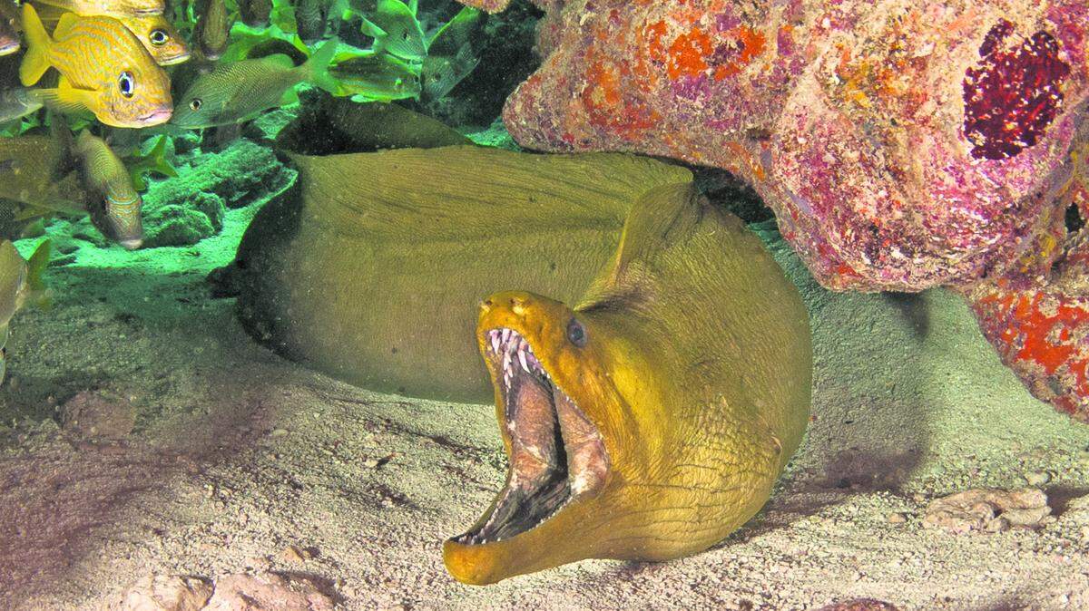
Manatees swim upstream from the bay to take refuge during winter months. Pelicans and egrets forage along the riverbanks, where decades-old pond apple trees hang over the water. Invasive species like the island apple snails thrive here, with their bubblegum pink egg clusters dotting the original coral rock of the canal dredged in the 1920s.
Suzanne Jewell, a self-described climate refugee who moved to El Portal after her house on Belle Meade flooded during Tropical Storm Eta last year, said she experienced a life-changing moment while kayaking in the Little River: She decided to quit a career in television production and focus on her mindfulness coaching business.
“I was observing a mother and baby manatee on a day when the river was full of floating trash. The baby approached my kayak and looked right at me as if to say ‘Look at this. You have to do something,’ ” said Jewell, who lives in a cozy cottage at the Open Awareness Buddhist Center, located in a lush garden with four large stupas, or meditation shrines, right on the Little River. “This river is full of life and it’s our responsibility to make it healthy again.”
The Village of El Portal, which covers five blocks from the river’s northern bank between I-95 and Biscayne Boulevard, looks like a green oasis in the densely populated river basin. Part of El Portal is an archaeological zone that includes a prehistoric Native burial mound — the first archaeological site to be recognized in the county — along with a prehistoric Native American village, a mid-19th-century pioneer home and a historic farming settlement. Radiocarbon dating suggests that the mound was built as early as 600 AD, while the prehistoric Native American village dates to 200 AD, according to the Village of El Portal’s website.
Much of the Little River was once what was known as a transverse glades — a natural sawgrass prairie stretching all the way to the original Everglades.
The river took a natural path from about where North Miami Avenue is, then east to Biscayne Bay, past a natural spring and on through mangrove forests before eventually emptying in the bay in a wide estuary at what is present-day Belle Meade, according to the Little River Conservancy, a nonprofit that advocates for the health of the river.
Dredging and damming
Then, in 1925, as Miami was growing, the river was dredged to create what is now the C-7 canal, with its current course. A large salinity control dam was installed by the South Florida Water Management District above Northeast 82nd Street in El Portal to control flow and prevent saltwater from moving too far inland.

The Little River starts near West Okeechobee Road and goes through a large residential and industrial stretch of Hialeah where used truck dealers, auto part shops and a gear and tool factory coexist with single-family homes and apartment blocks. A huge property from which a rigging and crane services company operates and a speed boat manufacturing plant are also right on the river, which is murky and more stagnant than its downstream sections.
Known as the C-7 canal in flood control parlance, the river receives stormwater that would otherwise flood parking lots, roads, junkyards, shopping malls and schools around it. That water then moves by gravity to Biscayne Bay.
Adding to the challenge, much of the Little River watershed is at a high risk of flooding and sea level rise is making it increasingly challenging to keep neighborhoods dry. With some homes at just three feet of elevation above sea level, areas of El Portal are the lowest in the county. Thousands of low-lying septic tanks regularly flood, leaching waste and bacteria into the canal. More frequent rainfall events mean more water flowing through parking lots and roads into the river. And all that water ends up in the bay.
Once again this summer, a fish kill hit Biscayne Bay over the Labor Day holiday weekend as oxygen levels dropped to levels too low to support marine life. It happened around North Bay Village and Normandy Isles, around the 79th Street Basin and in parts of the eastern side of the bay off Miami Beach.
Miami Waterkeeper, which documented more than 27,000 dead fish in the August 2020 kill that was the worst in recent memory, said it received reports of four different spots with dozens of dead fish on Labor Day. Though it was not nearly as severe as last year, the nonprofit’s director Silverstein said the warning remains the same when an unusual number of fish turn up dead: The Miami area is polluting Biscayne Bay to the point that the ecosystem is failing.
“It’s really death by a thousand cuts,” she said.
Zero oxygen
Scientists are trying to understand what triggers dissolved oxygen levels to plunge so suddenly in northern Biscayne Bay.
University of Miami coral researcher and ocean chemistry specialist Chris Langdon, who went out on his kayak to the area where the Little River meets the bay to sample the water where the fish kill happened last year, documented dangerously low oxygen levels. Since then, he has been sampling the water at different depths in the bay.
“At that moment last year we had no idea what had led up to the event, so we’ve been working to figure out how it all unfolded,” Langdon said. “The way oxygen is distributed at different depths in the bay can paint a more detailed picture to help us analyze pollution and nutrient patterns.”
That has a lot to do with how healthy the seagrass is because submerged aquatic vegetation produces oxygen during the day through photosynthesis and is a key feature of a healthy bay, he said.
Langdon enlisted graduate student Charles Groppe in May to test the water in different basins in northern Biscayne Bay for key water quality criteria: oxygen, temperature, salinity, turbidity and chlorophyll, which indicates the presence of algae that feed off nutrients and grow in warmer water, accelerating oxygen depletion.
Right off the bat, Langdon and Groppe’s research confirmed what a 2019 report from a Miami-Dade County seagrass and hard-bottom habitat study had already indicated: The northern part of the bay has lost 90% of seagrass cover since 2013, a conclusion that water quality advocates like Silverstein from Miami Waterkeeper describe as evidence the bay is at a tipping point.
In May, Groppe mapped out 177 locations in the northern bay and found that the situation hasn’t improved. In 2017, about 75% of seagrass meadows in northern Biscayne Bay had vanished, he said. At this rate, there will be nothing left in those basins, a trend that the National Oceanic and Atmospheric Administration attributed to a regime shift the bay is undergoing because of rising nutrient levels.
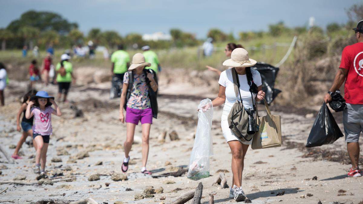
Reviving the bay may help revive the Little River as well, a dream for the people who love it and live alongside it. Adam Old and Kristen McLean, co-founders of the Little River Conservancy, want to do their own water quality monitoring to add to the data being produced around the canal and help drive more research. But they also want to offer more education programs and fun activities like canoeing tours. The Conservancy organizes an annual Little River cleanup and is involved in efforts to reduce solid waste in the waterway and to increase access for recreation.
“Most people who live in Miami don’t even know this river is here. But it’s an important part of Miami’s history and it’s full of life; manatees and birds live in the river and we want people to get to know it better and help restore it,” she said while canoeing in a stretch just south of I-95 where the original coral rock seawall is still visible.
“Ibises use the river as a superhighway to get from the Everglades to Biscayne Bay. It’s amazing.”
.jpg)