With UDB vote, Miami-Dade shows how hard it is to stop developing in flood-prone spots
READ MORE
Pushing the Boundary
With proposed UDB vote, Miami-Dade shows how hard it is to stop developing in flood-prone spots
Expand All
In the four years since Luis Leon bought his home in South Dade, he’s watched rainwater turn to floodwater at least ten times, creeping into his garage and leading, he suspects, to a crack in his home’s foundation.
“I didn’t know it flooded when I bought it,” he said.
He swears that Hurricane Irma’s storm surge brought schools of fish down his quiet street, which is right on the border of the county’s Urban Development Boundary, the invisible line demarcating land fit for development. Properties near that line, known as the UDB, are often among the most flood-prone in the county.
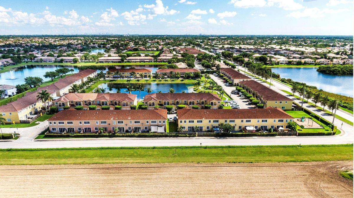
Now that Leon knows flooding is an issue, he worries it will worsen if Miami-Dade County Commissioners agree to turn the 800-acre agricultural lot next door into an industrial park by expanding that invisible development line.
When commissioners agreed last month to send a proposal to move the UDB to the state for review, foreshadowing a final vote in the coming months, they also made concrete a mostly theoretical battle about continuing economic development in vulnerable spots.
Though proponents say the proposed South Dade Logistics & Technology District would bring much-needed jobs to the area, Leon and county planning staffers worry that the development could cause flooding in nearby residential neighborhoods. Lee Hefty, head of the county’s department of environmental resources management, said the county needs to stop putting more people and buildings in spots that are destined to be flooded by sea level rise and storms.
“We need to quit making vulnerable areas,” he said. “We can’t continue to put people and development in harm’s way.”
Despite that warning from county staff, commissioners voted last month to submit the UDB-moving project from developers — the first proposed since 2013 — to state agencies for their review. After that’s completed, commissioners will have one more chance to approve or deny the project.
If approved, Aligned Real Estate Holdings would build 9 million square feet of commercial space, potentially including another Amazon warehouse, on land that is among the most vulnerable to storm surge and sea rise-driven flooding in the county.
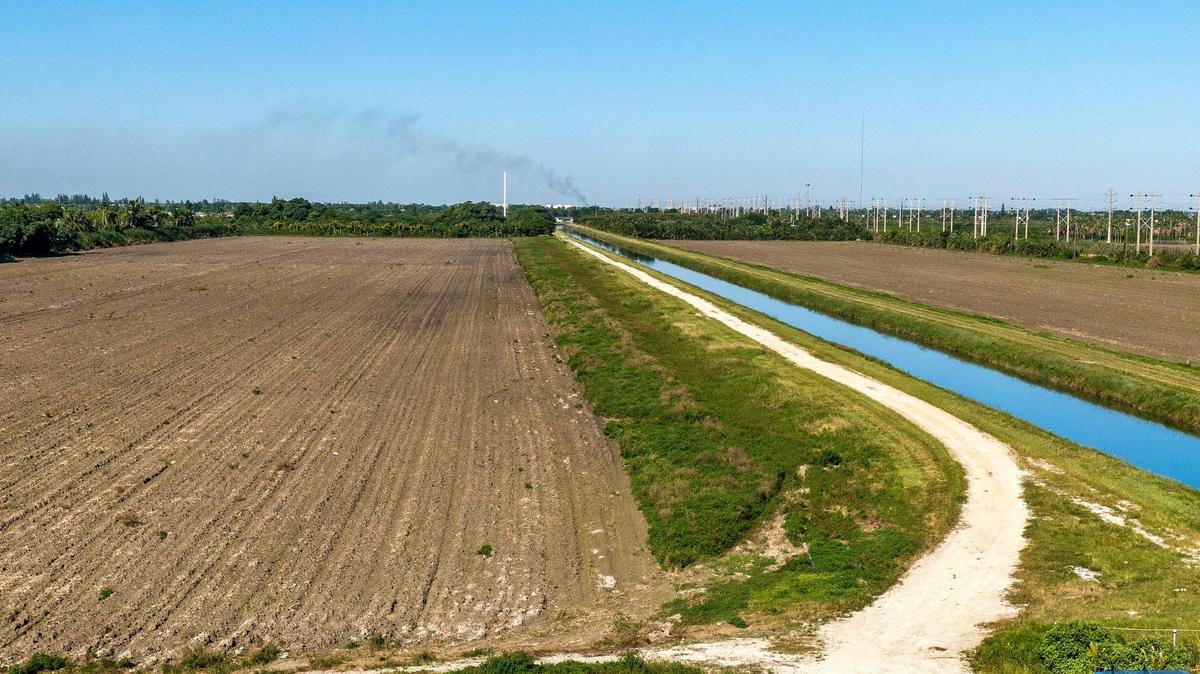
The land is a rectangular plot just south of the Turnpike extension that connects Homestead with the expressway. It’s bounded on the south by Southwest 268th Street and sits between 107th Avenue and 122nd Avenue.
The developers said they want to break ground as soon as January. And they say they are prepared to take extraordinary measures to make the project work.
Building above the flood
If a Category 1 storm hit today, it would soak the area with two feet of storm surge, putting it into a category known as a coastal high hazard zone. By 2060, if global warming-causing emissions are not curbed, that area would be under more than three feet of water after a 3-day rainstorm, according to a county staff analysis of the proposed project.
The county’s plans for development have strictly warned against new development of any kind in coastal high hazard areas since at least 2008.
To combat that, the developers said they would build stronger and higher — above what the code requires.
Roads into and throughout the development would be around 5 feet higher than they are now, and about six feet higher than Miami Beach’s newly elevated roads in Sunset Harbour. All buildings would be one foot higher than FEMA requires to maintain flood insurance, which would be about nine feet higher than the buildings that currently exist on the site.

Ed Swakon, an environmental consultant for the project and president of EAS Engineering, said the developers plan to pour dirt on the property to raise its elevation 6.5 feet above sea level and out of the coastal high hazard area.
Swakon said he believes the danger of the coastal high hazard designation has been “way overblown in significance,” which makes it sound like this development is at more risk than projects in other such areas like Miami Beach, Coconut Grove and Coral Gables.
“There are lots of areas that are coastal high hazard areas and I can guarantee we’re not going to stop developing there,” he said.
To address concerns that the property will dump stormwater on neighbors like Leon, Swakon said the plan would be to build a ring of dirt around the newly elevated property, maybe a foot or two high.
“We will be capturing all the stormwater on our property at a higher design criteria than is required by the county,” he said. “You can’t do things on your property that adversely affect your neighbors. That has been analyzed and there won’t be an impact.”
Despite promises from Aligned Real Estate Holdings that their calculations show the development won’t exacerbate flooding in the neighborhood, Miami-Dade County planners are skeptical. Hefty noted that the county’s porous aquifer makes it hard to contain water in one place.
“They make it sound like ‘Oh, we’ll retain it all on-site,’ but we know water doesn’t stay on-site,” Hefty said. “Every time you eliminate where water could go, you put more burden on the system.”
Development vs sea level rise
Miami-Dade faces more risk from rising seas than almost any other coastal county in the nation. Just three feet of sea rise by mid-century (the projection the county is using to guide new development) would put 53,000 homes, 83,000 people and $21 billion worth of real estate at risk, according to calculations by Climate Central.
The rising sea will eventually flood some areas permanently, and higher sea levels mean more storm surge, which makes hurricanes even more devastating in a region with a long history of horrible storms. And it’s unclear how many billions it will take to adapt the main flood control system in the area, the South Florida Water Management District, to keep the water at bay.
Keeping people safe means building higher and farther from the water, two goals specifically outlined in the county’s sea level rise strategy released last year.

“It doesn’t make sense from a resilience perspective to keep building closer to the bay and eliminating that buffer,” Hefty said. “Are we making the same mistake we’ve made for 20 years? We have to think differently. We can’t be stuck in the past.”
Swakon and the developers he represents contest that. He sees a clear difference between building additional homes in the path of rising seas and building a strong, safe office building.
“I would agree that this is not an ideal place for residential, but by the same token, this is an industrial park that can be designed to the hurricane standards that we have today and the building codes,” he said. “People aren’t going to be there during hurricanes. It provides an employment center that’s closer to where people live so you don’t have people on the roads in an emergency.”
The County Commission is now faced with a decision coastal governments are struggling with around the world: jobs now or safety later. Rob Moore, a senior policy analyst at the Natural Resources Defense Council, said the leap from committing to resilience in theory to committing in real life is tough for many local governments.
“If there’s jobs and dollars attached to a decision, local officials just too often jump at the dollars and jobs without any long-term thinking of how many dollars and jobs this is going to cost you when things go sideways,” he said.
Eve Samples, director of Friends of the Everglades, said she hoped that the state agencies reviewing the proposal would see the “obvious flaws” in the proposal and not allow it to move forward.
“It’s common sense that we should limit development in these areas if we’re going to pay to address them later,” she said.
This story was originally published October 20, 2021 at 6:00 AM.
