26 inches of rain? Why flood warnings are still posted in South Florida, and what’s next
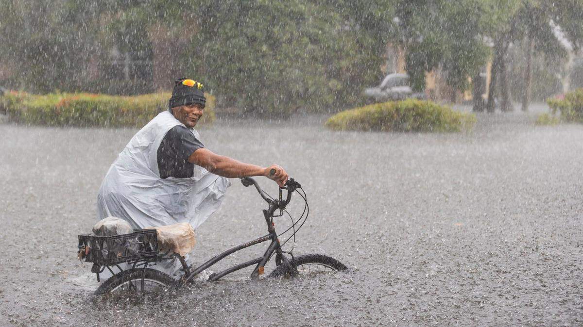
%20Hollywood%20Boulevard.JPG "A group of people in raincoats walk east along Hollywood Boulevard in the pouring rain on Wednesday, April 12, 2023.")
READ MORE
Soggy South Florida
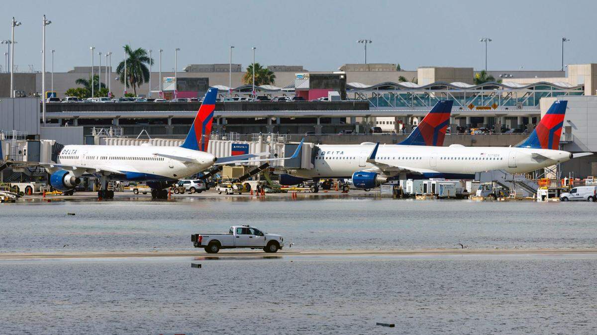
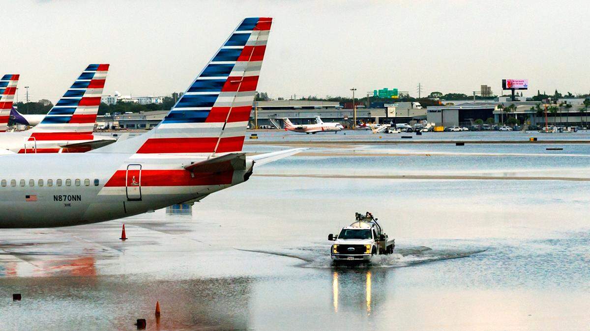
What to know about the flooding, rain and forecast, along with impacts to roads and Fort Lauderdale-Hollywood International Airport.
Expand All
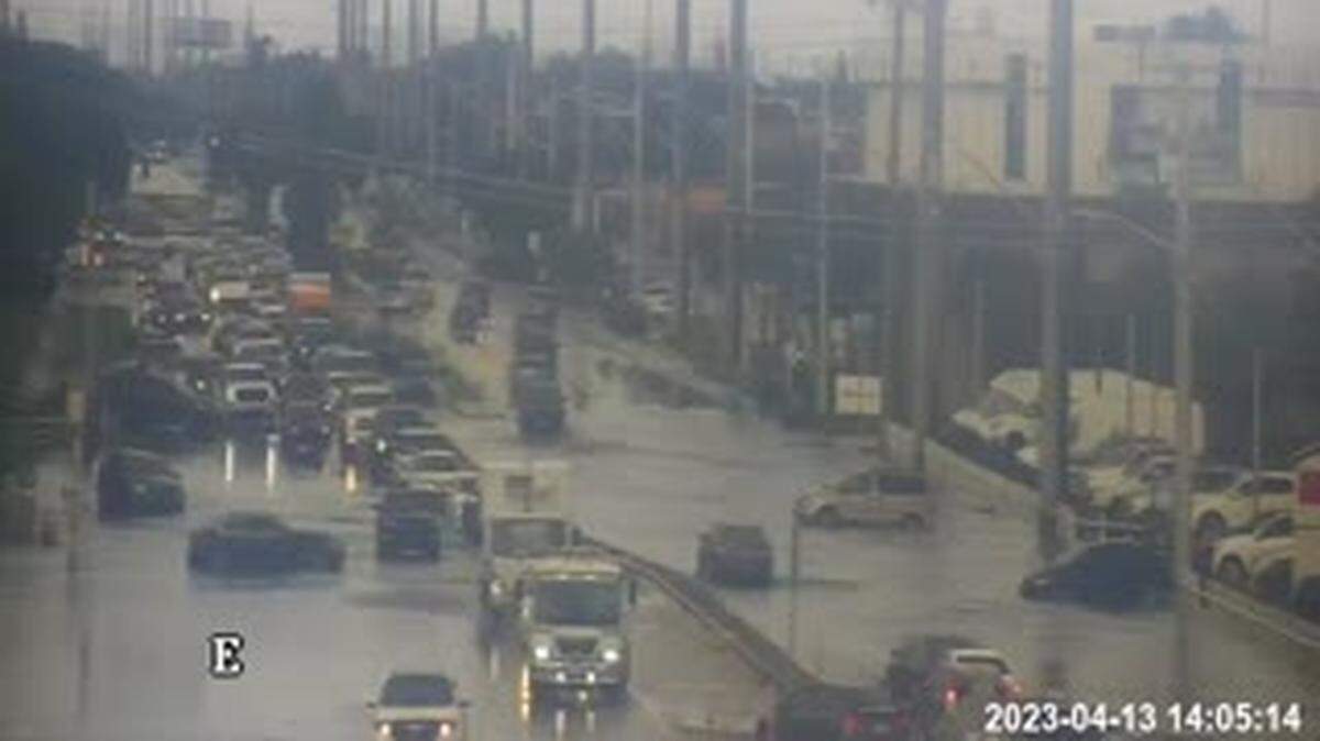
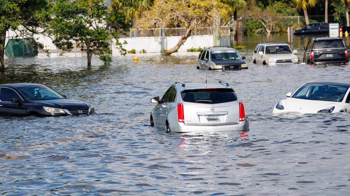
The four-day-long weather system over South Florida that culminated Wednesday with nearly 26 inches of rain flooding Fort Lauderdale and leading to the closing of schools and libraries on Thursday is not done with the region.
On Thursday morning, with the sun shining over saturated grounds, the National Weather Service in Miami extended its flood watch to 8 p.m. for metro and coastal Miami-Dade and Broward counties from Homestead to Coral Springs.
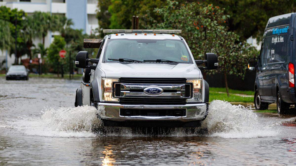
%20Dania%20Beach.JPG "fl-weather-06(2) Dania Beach.JPG")
Flood watch remains
The reasoning for the flood watch? Conditions are ripe for more rain Thursday.
“We’ve had a lot of recent rainfall. So, basically any storms that do move over the area today could pose a threat for flooding just because of all we’ve already seen,” said Luke Culver, a meteorologist with the National Weather Service in Miami.
Flood warning in Broward
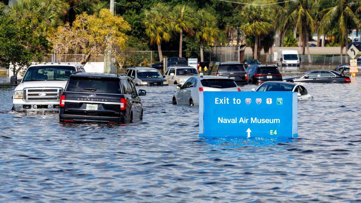
A flood warning remains in Broward County until noon given conditions are more imminent for flooding. Rainfall amounts between 16 and 20 inches have fallen since Wednesday’s deluge began, with Fort Lauderdale notching 25.91 inches, the weather service said when it released preliminary rainfall totals Thursday morning.
Flood warning locations. These Broward cities or destinations are under notice for possible flooding Thursday: Fort Lauderdale, Hollywood, Davie, Plantation, Sunrise, Lauderhill, Dania Beach, Chula Vista, Fort Lauderdale-Hollywood International Airport, Ravenswood Estates, Melrose Park, Downtown Fort Lauderdale, Estates of Fort Lauderdale, Washington Park, Broadview Park, Franklin Park, Port Everglades, Oak Point, Chambers Estates and St. George.
What Thursday’s forecast says

Thursday’s forecast: Meteorologists call for good chances for another late morning or afternoon round showers and thunderstorms, Culver said.
“Some might be strong to possibly even severe, which would obviously lead to the potential for damaging winds, possibly small hail — that’s a little bit lower of a threat — and an isolated tornado cannot be ruled out either,” he said.
He added that the weather service has a survey team out Thursday morning to determine if any tornadoes touched down Wednesday.
There were warnings.
Where are we most vulnerable? As for Thursday, the weather service and local meteorologists, like CBS News Miami’s Lissette Gonzalez, place the risk for severe storms as “slight” to “moderate.”
The weatehr center forecast calls for an afternoon 60% chance of heavy rain Thursday in the Miami area, falling to 30% in the evening.
The Fort Lauderdale area shares the 60% daytime forecast, falling to 40% Friday.
But if the storms do materialize they more likely will be to the north in Broward and Palm Beach County.
Rip current statement: A high risk for rip currents remains through Thursday night for beaches along coastal Miami-Dade, Broward and Palm Beach counties, the weather service noted.
Longer range forecast

Friday will bring drier air to South Florida and temperatures around 83 as a high and 75 as a low. There will be chances for showers or thunderstorms in the afternoon but less than we have seen in days, Culver says.
Saturday will be sunny, with temperatures running 77 to 83.
Another front is expected to move through South Florida Sunday evening, raising rain and storm chances to 40%, and 50% on Monday.
The Florida Keys will be mostly clear Thursday through the weekend with only a slight chance of rain Thursday and 30% Sunday night and Monday, according to the weather service in Key West.

This story was originally published April 13, 2023 at 11:36 AM.

%20Dania%20Beach.JPG)
%20Hollywood%20Boulevard.JPG)
%20Dania%20Beach.JPG)