‘Street is lake, urgent!’ Herald mapping reveals flooding blind spots
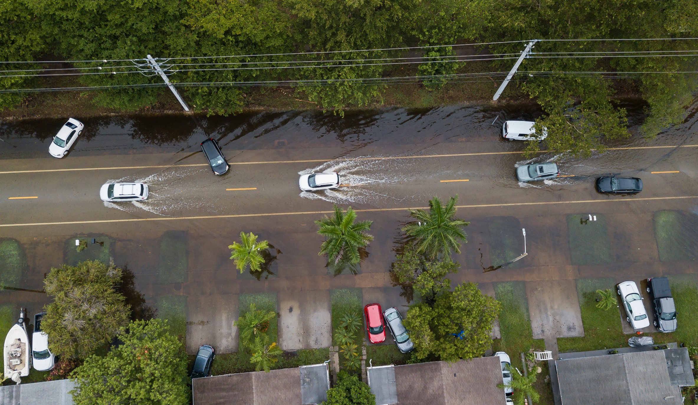
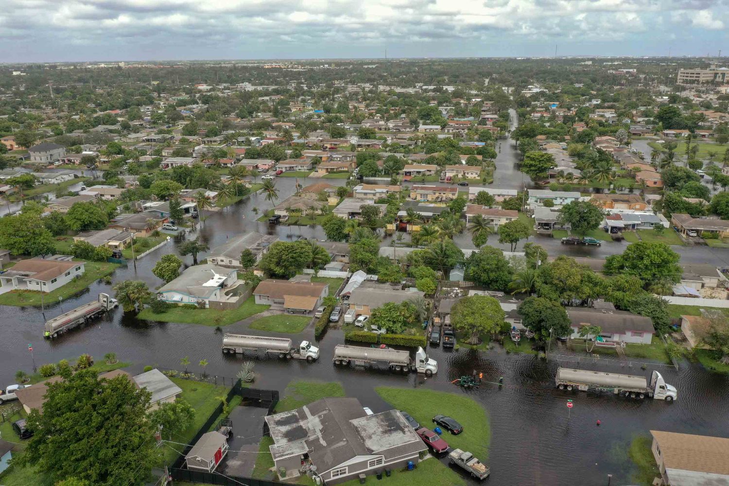
Those actual complaints are just a sampling of the thousands filed by residents who have found themselves with swamped and stalled cars, soggy and moldy homes or driving down a street so deep underwater they’re uncertain if it’s safe to cross.
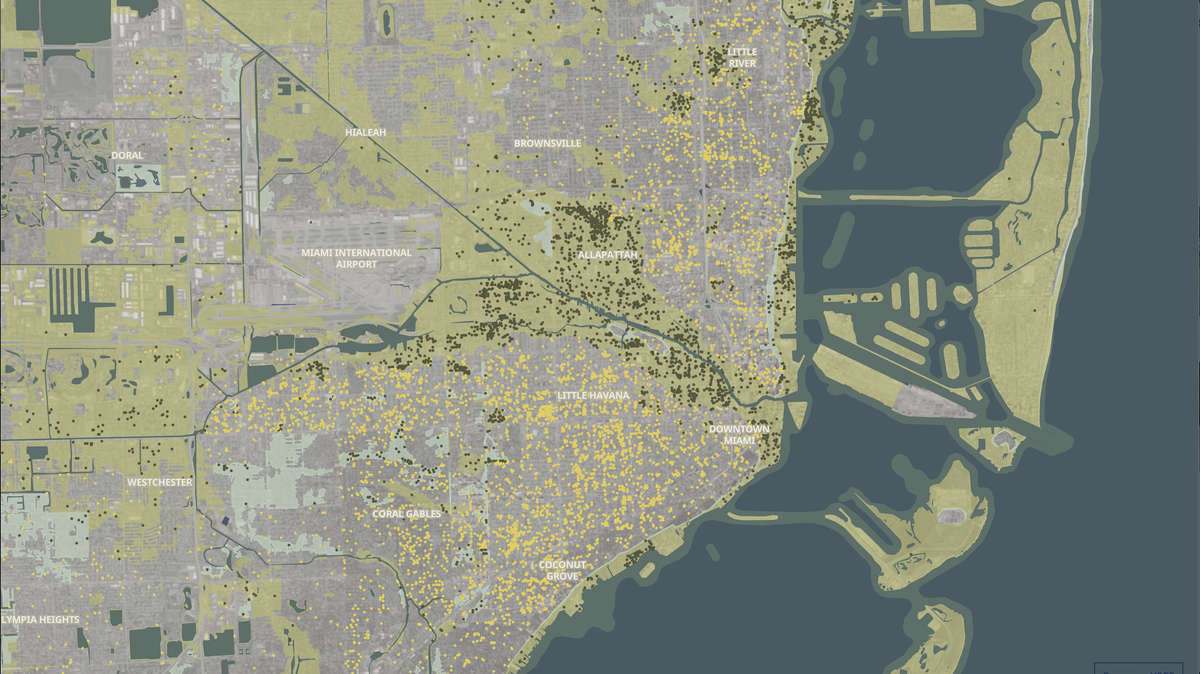
Nearly a decade of records examined by the Miami Herald show flooding is far more widespread than previously known across South Florida, revealing clusters of complaints in areas that federal flood insurance zones classify as at little to no risk of flooding. The record points to problem areas that are largely untracked and unknown, except to the residents who must deal with it.
But no city, county or state agency publicly documents residential flood complaints, a Miami Herald investigation found, or provides the public with mapping of neighborhoods with reported flooding histories. The Herald, using the best available data – 16,569 flood complaints from more than 12,000 locations in Miami-Dade and Broward over the last 11 years – has put together the most comprehensive maps of documented flooding to date.
But these, too, admittedly provide only a partial picture and almost certainly underestimate the problem.
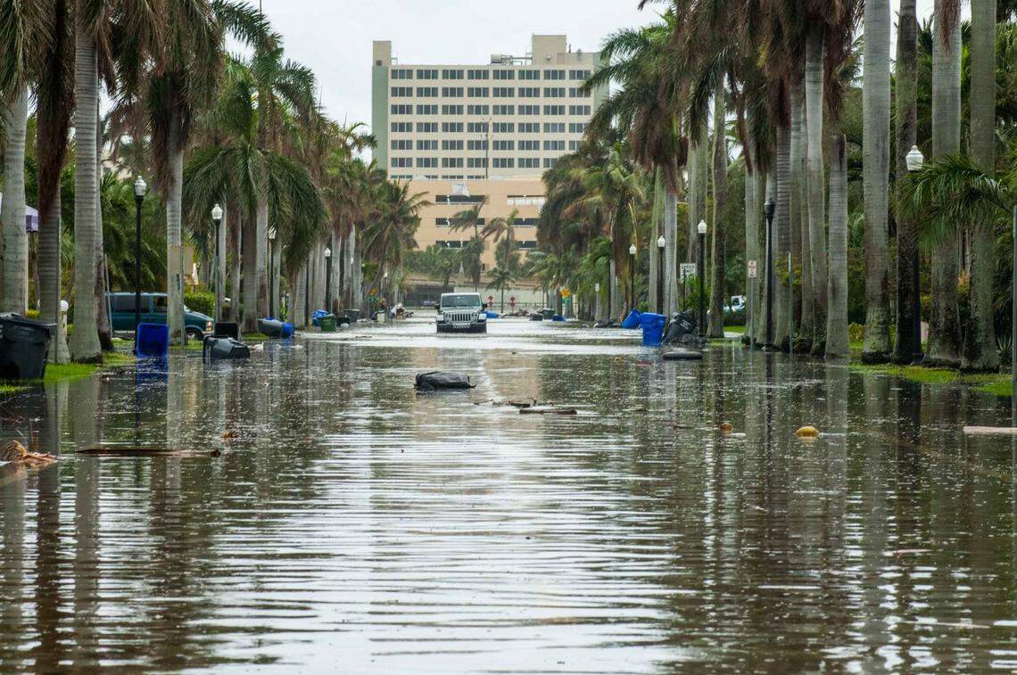
That’s because lots of flooding is never reported to any agency. And to further muddy the waters, The Herald found, there are no standards for flood complaints, so it can be difficult to separate dangerously impassable streets from typical ponding after heavy rains. Some listed flood complaints are serious, like when waters breach a structure. Others might count a clogged drain on a street as neighborhood flooding.
And some communities don’t even document flood complaints – Monroe County, which covers the entire Florida Keys, and the village of Miami Shores, for instance. That means there are big data gaps not only on where flooding happens but also on how bad it is.
But, The Herald found, one thing is clear: Standard government-created maps often offer an incomplete — and potentially misleading — picture of the risk of flooding and damage that runs into the millions of dollars in South Florida every year, often without a tropical storm or hurricane. That means communities planning development and flood-protection projects may be underestimating risks, which will only rise with climate change, and home buyers making what is, for many, the biggest investment in their lives may be wading into a future flood of trouble.
“If you do not report your flooding, your community cannot deliver the solutions you need,” said Julia Kumari Drapkin, founder of ISeeChange, a company that crowdsources flood complaints and delivers them to city and county governments to help identify problem areas.
Anybody who has ever taken out a mortgage in South Florida has learned about flood maps. The maps, created by the Federal Emergency Management Agency in consultation with counties, are considered the gold standard of flood threat assessment, and really the primary source for home buyers, although third-party offerings like First Street Foundation’s Flood Factor tool are gaining ground.
Are you in a flood zone? You’ll need flood insurance, and you might flood. If you’re out, the thinking goes, you’re safe.
But the Herald analysis of records shows that a massive number of flood complaints in Broward and Miami-Dade happen outside of those lines.
Miami-Dade has been updating those new FEMA maps for four years, and they could go into effect as soon as next year.
The new maps show more communities in flood zones, particularly in the Coral Way and Little River neighborhoods. More than 40,000 homes in Miami-Dade alone will be added to a high-risk flood zone, according to FEMA.
But, the Herald found, that still leaves thousands of people in spots that flood — even though they’re outside of formal flood zones.
Dangers outside of a flood zone
FEMA flood maps are most people’s main reference for the danger their home faces from future flooding. But plenty of people live in floodprone spots that aren’t marked on even the most up-to-date maps — leaving them mostly in the dark when it comes to the risk of water seeping under their front door.
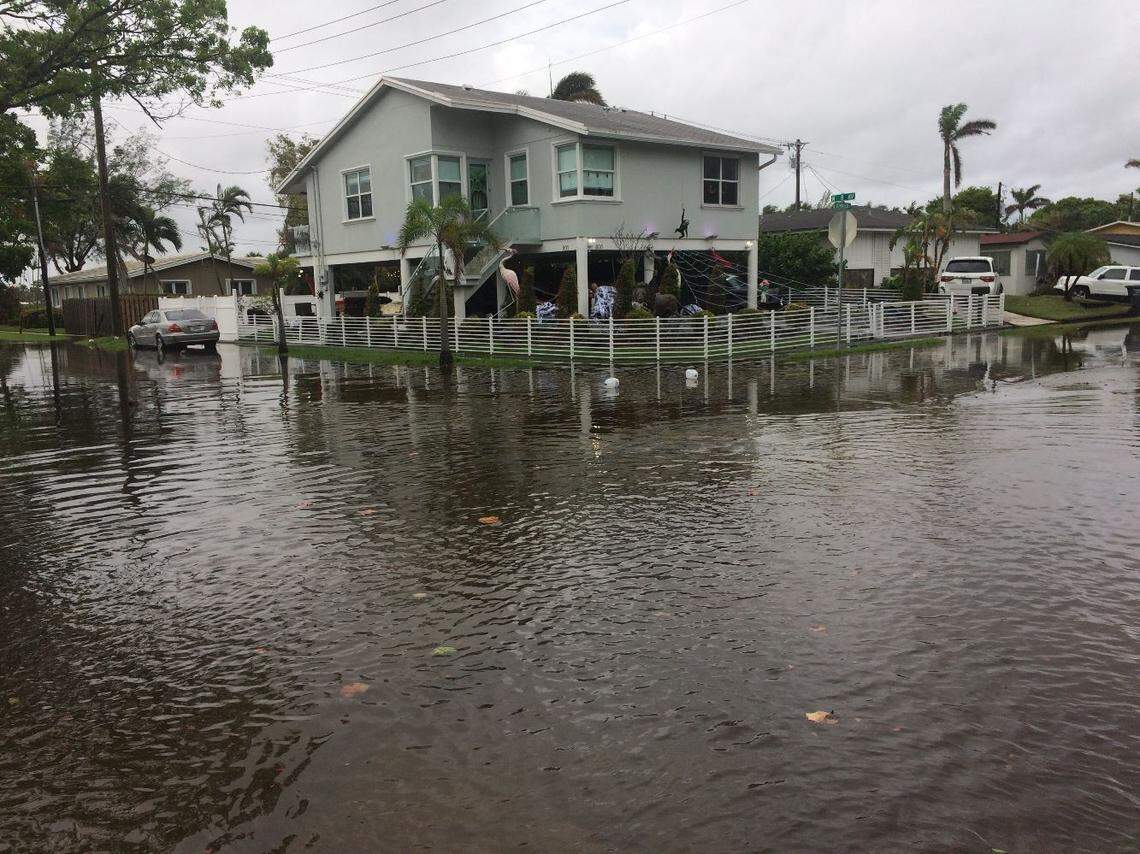
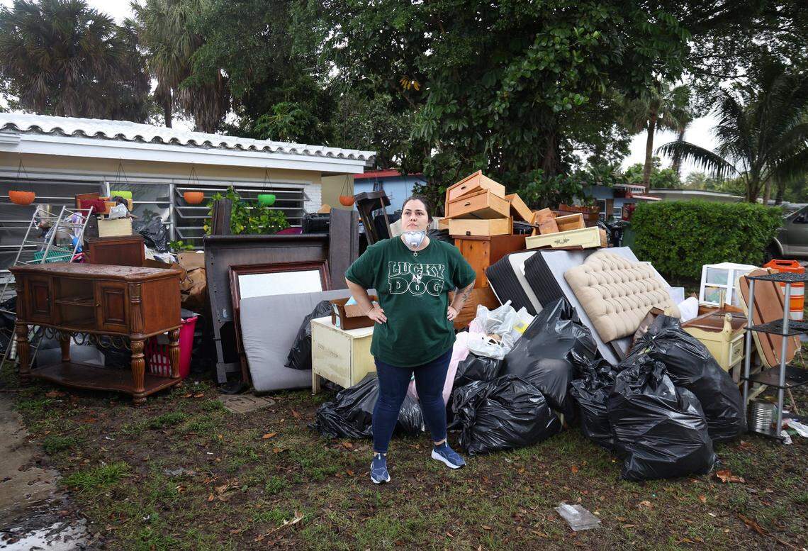
One such spot is Allapattah, where rainstorms can send several feet of water into low-lying houses and apartments, even outside an official flood zone.
As recently as early October, a few inches of heavy rain was enough to inundate streets and encroach on local businesses.
Stories like Benzant’s aren’t public, so would-be home buyers or renters in his neighborhood would have no clear picture of the flood risk potentially awaiting them.
After years of pressure, Florida recently changed its laws, requiring sellers — for the first time — to warn buyers and renters if their property has flooded in the past. But some legal experts worry that it won’t be enforced, leaving potential buyers still in the dark.
FEMA keeps a list of all properties that have flooded repeatedly, at least those reported to the government through its flood insurance arm, the National Flood Insurance Program. But, as The Herald reported in the first installment of this series, it keeps that information secret. And the flood maps it produces using that information have long been dogged with complaints that they’re inaccurate and backwards-looking, not taking into account the increased flooding issues climate change is bringing.
Mike Sukop, a professor at Florida International University who researches flooding in South Florida, called it “depressing” that even scientists — much less homebuyers — can’t access this information.
“We don’t have the information. You can’t make our models reliable without that groundtruthing. That’s what we need,” he said. “This whole recognition that it’s being kept secret from us is devastating.”
Unmapped, out of sight
FEMA maps aren’t the only way to track where it has and hasn’t flooded. Some local governments track flood complaints and map them, like the city of Miami and Miami-Dade County, but that information is not made easily accessible to the public. For instance, those flood complaints may help form a city’s stormwater masterplan, which helps identify where new drainage needs to be installed, but not in a way where a would-be homeowner could find out if their potential new home is on a street with a bevy of complaints.
This map of South Florida flood complaints is incomplete for many reasons, namely because some local governments simply don’t keep track of which spots flood. And sometimes, neighboring cities have different policies for tracking flood complaints, leading to a patchwork map of flood problems.
A rare window into bad floods
Incomplete mapping makes it difficult to get a sense of how common flooding actually is in any one neighborhood. But an extreme event in Fort Lauderdale in 2023 offers a window into how bad a single, terrible flood can be.
When 25 inches of rain fell in 24 hours in Fort Lauderdale, it swamped runways at the airport, inundated roads, cars and houses. Lots of houses.
In a bid to get FEMA to reimburse them for some of the damages, the city committed to a meticulous count of every flooded house in one neighborhood. It posted the details of these flooded properties in a publicly accessible database in a rare case of transparency. It revealed widespread damage.
Within city limits, Fort Lauderdale found more than 1,100 homes with “severe damage” — more than 18 inches of water inside a home, and more than 300 with minor damage. The city later revoked public access to that map of ruined homes.
Scientists say flooding could worsen
Experts classified the massive flood in Fort Lauderdale a “1-in-1,000 year event” and city officials said building drainage abilities to be able to handle that much rain was unrealistic. But a growing body of research suggests that climate change is likely to make floods like that more common.
Sukop, the FIU flood researcher, said it’s already playing out in coastal spots in Miami-Dade and Broward Counties. That’s thanks to a quirk of South Florida’s geology, where the entire region is perched on holey rock that does little to stop the rise of groundwater, which Sukop’s research has shown is rising on pace with sea level.
“In areas where the sea level rise is raising the groundwater table, which could be pretty far inland in Miami, we don’t know what the limits are on that,” he said. “It can rise pretty freely, basically.”
The conclusion, he said, is that without further investment in elevating and protecting homes and roads and businesses in South Florida, flooding is likely to get more common and worse.
“It’s getting worse with sea level rise,” he said. “We can say that.”
This story was originally published November 12, 2025 at 5:00 AM.