Hurricane center is watching a new system in the Atlantic. What forecasters are saying
Forecasters are keeping an eye on a new system in the Atlantic, the National Hurricane Center said in its tropical weather outlook Wednesday night.
Here’s what to know:
A new system
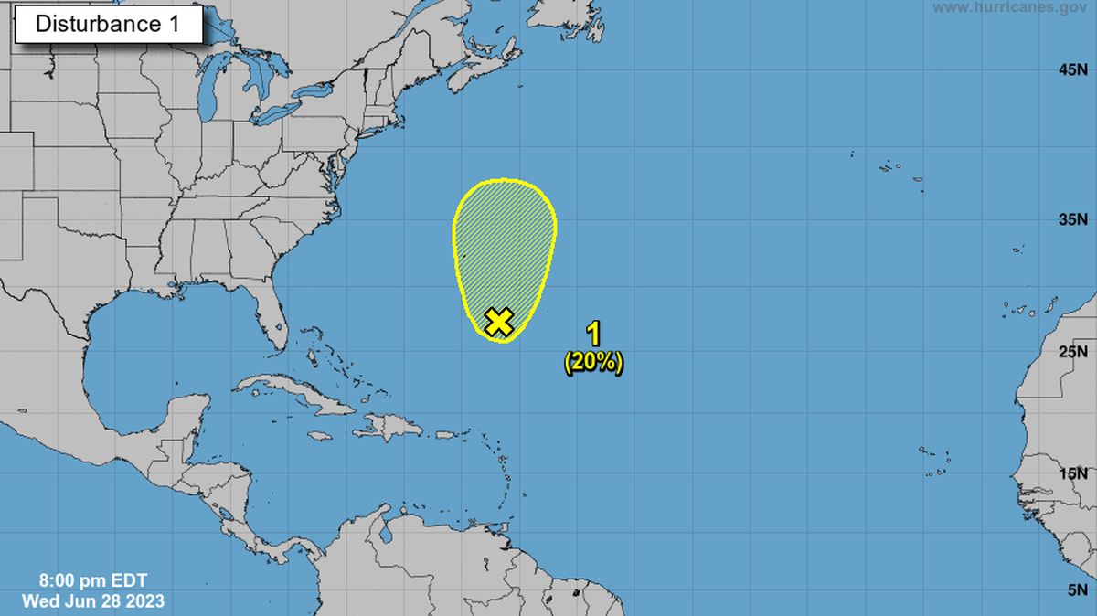
Key points: Area of disturbed weather, associated with a surface trough, has formed.
Location: A few hundred miles south-southeast of Bermuda.
Movement: “Upper-level winds are marginally conducive for some slow development of this system during the next few days while it moves generally northward at 5 to 10 mph,” the hurricane center said.
Forecast: Formation chance through 48 hours is a low 10% and formation chance through seven days is a low 20%.
Remnants of Tropical Storm Cindy
The National Hurricane Center is no longer tracking Cindy’s remnants. As of the 8 a.m. outlook:
Key points: Forecasters don’t expect Cindy to redevelop into a zombie storm after fizzling out over the weekend. Right now, it’s a weak trough with rain.
Location: About 400 miles south-southwest of Bermuda.
Movement: The system is expected to drift toward the west-northwest during the next couple of days, and redevelopment is not expected due to strong upper-level winds.
Forecast: Formation chance through 48 hours through seven days is low, near 0%.
This story was originally published June 28, 2023 at 9:48 AM.

%20Cropped%20(2).jpg)