How do the Hurricane Isaias models treat Florida? ‘Pick your poison,’ forecaster says
There is no one path for a hurricane.
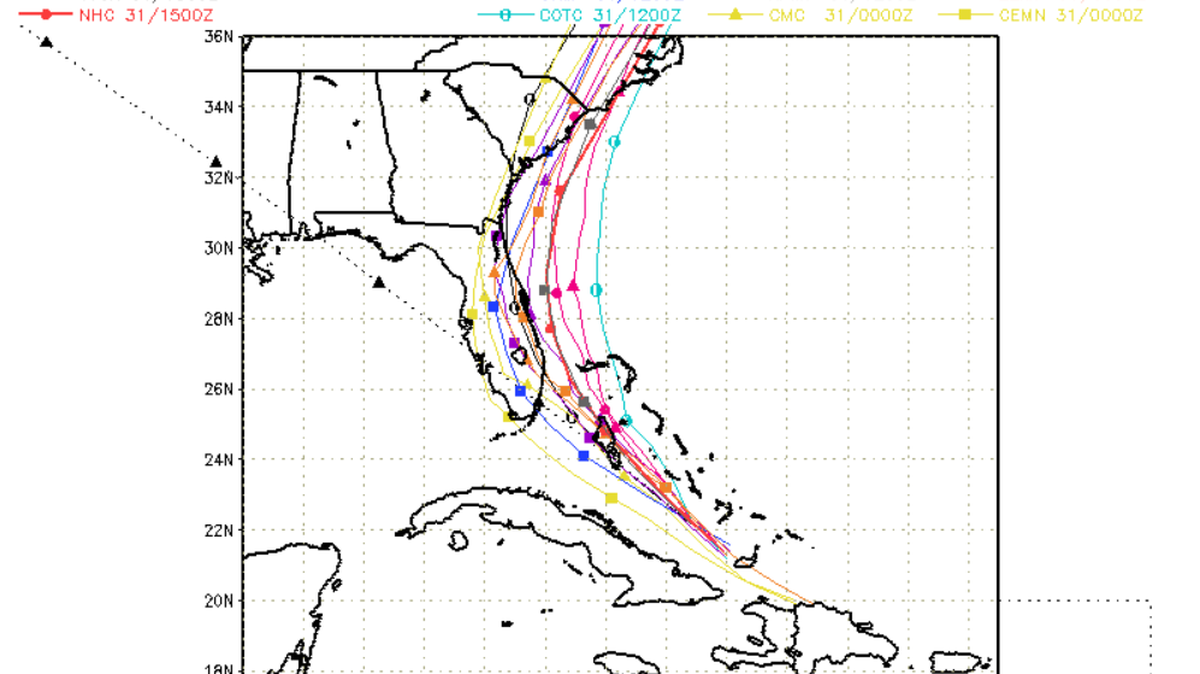
Computer models are often all over the place.
Many of the models, commonly called spaghetti plots, agree that Hurricane Isaias will bring stormy conditions to South Florida this weekend — but some show the storm moving more inland than others.
So, what are the best case/worst case tracks for South Florida?
It’s more of a “pick your poison type of scenario,” said National Weather Service Meteorologist Paxton Fell.
Isaias is forecast to bring heavy rain, strong winds, possible flooding and “life-threatening” surf and rip current conditions along the east coast of Florida this weekend.
How wet and windy are we talking about?
It depends on how close it gets to Florida’s coast, Fell said.
A weaker, less organized Isaias could shift its track more to the west, bringing it closer to Florida’s east coast, according to the National Weather Service. That means the region could potentially feel more of its hurricane-and tropical storm-force winds, rain and swells.
“The more it struggles, the greater chance of a Florida landfall,” tweeted Levi Cowan, a meteorologist at the University of Miami’s Rosenstiel School of Marine and Atmospheric Science. “Be prepared for possible tropical storm impacts there.”
A stronger, organized Isaias could keep its track to the east, toward the Bahamas, keeping it offshore from Florida, according to Fell, the NWS meteorologist. That means the region would still feel Isaias’ stormy weather, but not as much.
The National Hurricane Center’s 2 p.m. track update shows that Isaias is “getting better organized” and is forecast to approach the northeast Bahamas and Florida’s east coast on Saturday as a powerful Category 1 with 90 mph winds before weakening again as it crawls up the east coast.

While there is still some uncertainty about the storm’s track and intensity, the hurricane center is predicting that South Florida to east Central Florida could see two to four inches of rain, with some spots seeing six inches, from Friday night to Monday.
This may cause “isolated flash and urban flooding, especially in low-lying and poorly drained areas,” forecasters wrote.
As of 2 p.m. Friday, southeast Florida from Ocean Reef north to the Sebastian Inlet and Lake Okeechobee remain under a tropical warning. A hurricane watch is also in effect from north of Deerfield Beach to the Volusia-Brevard County Line.
Miami Herald staff writer Alex Harris contributed to this report.
This story was originally published July 31, 2020 at 3:48 PM.
