
Underline’s Dadeland to South Miami segment is now open, with these new features
The latest piece of The Underline to open to the public is the end of the trail, even though the project’s not quite done yet.
The 1.2-mile stretch, now finished and ready for exploration on foot, by bike or by e-means of transportation, is the southernmost leg of the Underline, which on its planned completion later this year will run a continuous 10 miles from Dadeland to its already finished northern endpoint at Brickell and the Miami River.
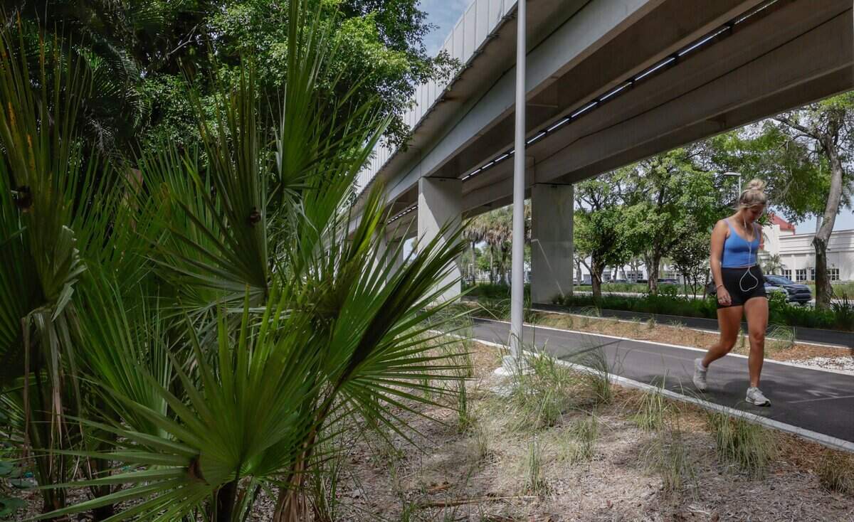
The new section, from the Dadeland South Metrorail station to Southwest 80th Street in South Miami, bookends the Underline with its trademark green — the color of both its rich landscaping and its furnishings and signs — and a couple of new and different features to check out.
A lush butterfly garden and a village for birds, consisting of an architecturally arresting array of Underline-green birdhouses, mark that north entry point to the trail’s southernmost segment.

A bit father south, in one spot near the butterfly garden and another just past Southwest 70th Avenue, there are examples of a cutting-edge Underline element — a micro-forest. As the name suggests, these are compact clusters of trees and shrubs that mimic a natural forest. Made of up native species, they’re designed to grow rapidly into a dense clump of green that supports wildlife, creates a cool microclimate and restores lost biodiversity to the traffic-clogged U.S. 1 corridor.
There’s more Underline to come very soon. The next section to the north, connecting through South Miami to the edge of Coral Gables, is virtually finished and set to officially open next month — though construction fencing is gone and people are already using it.
A length of Underline opened earlier this year through Coral Gables north of LeJeune Road — the location of its instantly popular new Chewy Bark Park — to Southwest 27th Avenue and Coconut Grove. That bit already connects all the way to the river.
MORE PHOTOS: Take a peek at the Underline’s newest section, complete with ‘micro-forests’
What that means is all that remains to be filled in is a section in the very middle, in Coral Gables along the University of Miami. That piece — which will contain some of the Underline’s most elaborate features — is well underway and, Miami-Dade County and the Friends of the Underline organization promise, will be finished before the end of the year.
There are a few caveats, however. Both Dadeland Metrorail stations as well as the Douglas Road station are under extensive renovation, expansion or redevelopment, and trail connections through them are sketchy or missing altogether. The Underline is meant as both a recreational and transportation trail, connecting Metro and bus stations along the route to adjacent neighborhoods and businesses.
At Dadeland North, an existing trail connection behind the station garage that was part of the old M-Path, the bare-bones track that the Underline replaced, is blocked off during construction. A path through the station itself is marked in green Underline circles on the floor, but signs say cyclists must dismount and walk the tenth of a mile from one end to the other — so anyone wearing bike shoes with cleats, beware.
The portion of the Underline connecting the two stations, though landscaped, is mostly utilitarian, given the narrowness of the rail corridor at that end, and it lacks any of the gardens or features the trail is known for. The last little bit before Dadeland South is also unfinished and awaiting the end of station construction, so users must navigate a narrow alley between fences and then a maze of signs and traffic cones to reach it.
Users should also be keenly aware at some potentially hazardous crossings at major intersections, especially at Kendall Drive and the exit ramp for State Road 878. Intersections along the Underline have been significantly improved for the safety of people on foot or on two wheels, with bright-green street crossings, signs and other markings and, in some places, new no-right-on-red fixed and electronic signs.
But at Kendall Drive and 878, many drivers were clearly not looking out for the pedestrians and cyclists who were out using the Underline at midday on Tuesday. Numerous motorists were observed by Miami Herald journalists ignoring stop signs and lights, sometimes blowing through them at high speed, and blocking clearly marked crosswalks.
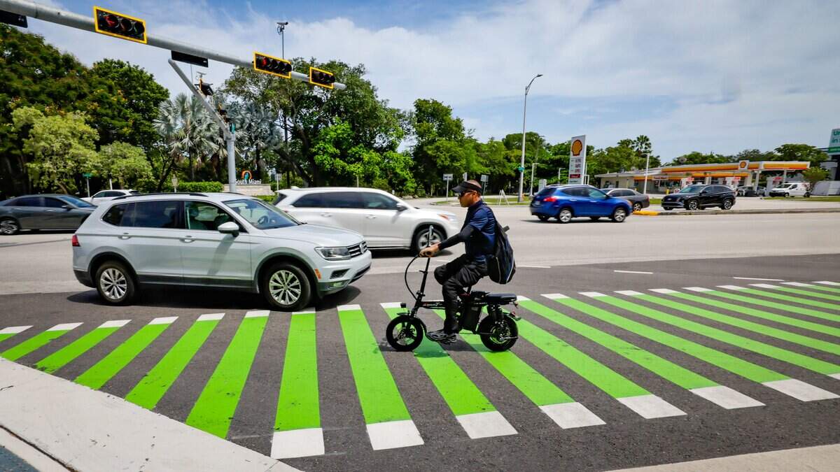
One especially hazardous spot was the crossing at a lane that splits off Kendall Drive for drivers turning south on U.S. 1. Though it’s clearly marked with a crosswalk and a stop sign, few motorists were seen to make the required full stop.
Jonathan Daniels, who was asking for money at the Kendall Drive intersection, his usual spot, told the journalists he had seen several Underline users struck by cars as they attempted to cross at that spot. “One or two,” he said, were picked up by ambulance.
“It’s bad, I’m telling you,” he called out to a reporter who was attempting to cross on a bike and had the right of way but was blocked by a car stopped in the middle of the marked crosswalk beyond the stop sign.
Eulois Cleckley, chief executive of Friends of the Underline, a nonprofit that manages and maintains the trail, said the group has worked with Miami-Dade and Florida Department of Transportation engineers, who oversee U.S. 1 and intersecting roads, to continue to improve crossings once they’re open if trouble spots become evident.
“They’ve been great partners,” Cleckley said.
Many Miami drivers are unaccustomed to yielding to pedestrians and cyclists, he acknowledged. He said there is sometimes “a long learning curve” for drivers and Underline users figuring out how to safely navigate the trail crossings.
Meanwhile, some businesses along the new trail segment are already seeing some additional foot traffic from users. While there’s an Underline bike service stand with tools and a tire pump for quick repairs at Southwest 80th Street, visitors are popping into the adjacent SOMI Bike Shop for service, bike gear and snacks and beverages, employees said.